Taxon Details
Sedum laxum ssp. heckneri
Heckner's stonecrop
View Report Copy Link Calflora eFlora CCH CalPhotos iNaturalist
Taxon Summary:
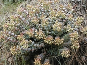
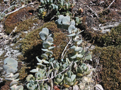
Sedum laxum ssp. heckneri, commonly known as Heckner's stonecrop, is a perennial herb in the Crassulaceae that is found in California and elsewhere. It occurs within Lower montane coniferous forest, and Upper montane coniferous forest, growing at elevations from 100 to 2100 meters. Sedum laxum ssp. heckneri is ranked 4.3, Plants of Limited Distribution, A Watch List; Not very threatened in California.|
Scientific Name: Sedum laxum (Britt.) Berger ssp. heckneri (Peck) Clausen |
||
|
Common Name: Heckner's stonecrop |
||
| Family: | Crassulaceae | |
| Element Code: | PDCRA0A0L3 | |
| USDA Plants Symbol: | SELAH | |
|
Synonyms/Other Names: |
||
| Name Status: |
JEF, FNA, POWO, IPNI, Tropicos |
|
| CA Rare Plant Rank: | 4.3 |
| Fed List: | None |
| State List: | None |
| Global Rank: | G5?T4 |
|
State Rank: |
S4 |
| Other Status: | |
|
CRPR Changes: |
|
| Add Date: | 1980-01-01 |
| Date Edited: | 2025-10-29 |
| Lifeform: perennial herb | ||||||||||||||
Blooming Period: Jun-Jul
|
||||||||||||||
|
Elevation:
100 - 2100 meters 330 - 6890 feet |
||||||||||||||
General Habitats:
|
||||||||||||||
| Microhabitat Details: | ||||||||||||||
Microhabitat:
|
||||||||||||||
| Threat List Total: | 0 | |
| Total EOs | % of EOs | |
| EOs with Threat Listed: | 0 | 0 % |
| THREAT LIST: | ||
|---|---|---|
| Total Occurrences: | 0 | ||||
| Element Occurrence Ranks: | |||||
|---|---|---|---|---|---|
| A | B | C | D | X | U |
| 0 | 0 | 0 | 0 | 0 | 0 |
| Occurrence Status: | |||||
|---|---|---|---|---|---|
| Historical >20 Years | 0 | ||||
| Recent <=20 Years | 0 | ||||
| Presence: | |||||
|---|---|---|---|---|---|
| Presumed Extant | 0 | ||||
| Possibly Extirpated | 0 | ||||
| Presumed Extirpated | 0 | ||||
| California Endemic: | |||||||||||||
| California Island: | |||||||||||||
|
States: Name (Code) California (CA), Oregon (OR) |
|||||||||||||
|
California Counties and Islands: Name (Code) Del Norte (DNT), Humboldt (HUM), Siskiyou (SIS), Trinity (TRI) |
|||||||||||||
|
Quads: Name (Quad Code) Bark Shanty Gulch (4112345), Bear Peak (4112365), Black Lassic (4012335), Board Camp Mtn. (4012366), Broken Rib Mtn. (4112386), Chimney Rock (4112356), Clear Creek (4112364), Denny (4012384), Devils Punchbowl (4112376), Dillon Mtn. (4112355), Dutch Creek (4112381), English Peak (4112342), Figurehead Mtn. (4112383), Fish Lake (4112336), Forks of Salmon (4112333), Grouse Mtn. (4012376), Happy Camp (4112374), High Plateau Mtn. (4112388), Hoopa (4112316), Hopkins Butte (4112325), Ironside Mtn. (4012374), Johnsons (4112337), Kangaroo Mtn. (4112382), Lonesome Ridge (4112346), Lord-ellis Summit (4012387), Mount Eddy (4112234), Naufus Creek (4012343), Orleans (4112335), Orleans Mtn. (4112334), Preston Peak (4112375), Ruth Reservoir (4012334), Salmon Mtn. (4112324), Salyer (4012385), Seiad Valley (4112372), Shelly Creek Ridge (4112387), Ship Mountain (4112367), Slater Butte (4112373), Somes Bar (4112344), South China Mtn. (4112235), Summit Valley (4112357), Trinity Mtn. (4112314), Ukonom Mtn. (4112354), Weitchpec (4112326), Willow Creek (4012386), Yellow Dog Peak (4112341) |
|||||||||||||
Notes:
|
|||||||||||||
 Presumed Extant
Click on quad for name. Hold Shift Key to use mouse scroll wheel


