Taxon Details
Eriastrum tracyi
Tracy's eriastrum
View Report Copy Link Calflora eFlora CCH CalPhotos iNaturalist
Taxon Summary:
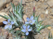
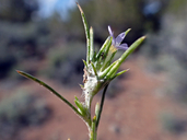
Eriastrum tracyi, commonly known as Tracy's eriastrum, is a annual herb in the Polemoniaceae that is found only in California. It occurs within Chaparral, Cismontane woodland, and Valley and foothill grassland, growing at elevations from 315 to 1780 meters. Eriastrum tracyi is ranked 3.2, Plants About Which We Need More Information, A Review List; Moderately threatened in California.|
Scientific Name: Eriastrum tracyi H. Mason |
||
|
Common Name: Tracy's eriastrum |
||
| Family: | Polemoniaceae | |
| Element Code: | PDPLM030C0 | |
| USDA Plants Symbol: | ||
|
Synonyms/Other Names: |
||
| Name Status: |
JEF, FNA, POWO, IPNI, Tropicos |
|
| CA Rare Plant Rank: | 3.2 |
| Fed List: | None |
| State List: | CR (1982-07-01) |
| Global Rank: | G3Q |
|
State Rank: |
S3 |
| Other Status: | USFS_S |
|
CRPR Changes: changed from 1B.2 to 3.2 on 2012-08-23 |
|
| Add Date: | 1974-01-01 |
| Date Edited: | 2023-01-10 |
| Lifeform: annual herb | ||||||||||||||
Blooming Period: May-Jul
|
||||||||||||||
|
Elevation:
315 - 1780 meters 1035 - 5840 feet |
||||||||||||||
General Habitats:
|
||||||||||||||
| Microhabitat Details: | ||||||||||||||
|
Microhabitat:
|
||||||||||||||
|
Notes: Previously CRPR 1B.2. Plants from COL, GLE, THE, and southern SHA cos. may be attributable to E. brandegeeae or undescribed taxa. Plants from the southern Sierra differ slightly from northern CA plants and may belong to an undescribed taxon; needs further study. See Madroño 8(3):87 (1945) for original description, and Madroño 55(1):82-87 (2008) for additional taxonomic information. |
|
|
Threats: Threatened by vehicles, competition, development, grazing, and road maintenance. A synonym of E. brandegeeae in TJM (1993). See Madroño 8(3):87 (1945) for original description, and Madroño 55(1):82-87 (2008) for additional taxonomic information. |
|
|
Taxonomy: A synonym of E. brandegeeae in TJM (1993). |
|
| Threat List Total: | 14 | |
| Total EOs | % of EOs | |
| EOs with Threat Listed: | 79 | 66 % |
| THREAT LIST: | ||
|---|---|---|
| Road/trail construction/maint. | 37 | 31% |
| Grazing | 33 | 27% |
| Development | 26 | 21% |
| Non-native plant impacts | 23 | 19% |
| Other | 10 | 8% |
| ORV activity | 8 | 6% |
| Foot traffic/trampling | 7 | 5% |
| Recreational use (non-ORV) | 3 | 2% |
| Wood cutting or brush clearing | 2 | 1% |
| Improper burning regime | 2 | 1% |
| Logging | 1 | 0% |
| Mining | 1 | 0% |
| Erosion/runoff | 1 | 0% |
| Vandalism/dumping/litter | 1 | 0% |
| Total Occurrences: | 119 | ||||
| Element Occurrence Ranks: | |||||
|---|---|---|---|---|---|
| A | B | C | D | X | U |
| 19 | 54 | 9 | 2 | 0 | 35 |
| Occurrence Status: | |||||
|---|---|---|---|---|---|
| Historical >20 Years | 55 | ||||
| Recent <=20 Years | 64 | ||||
| Presence: | |||||
|---|---|---|---|---|---|
| Presumed Extant | 119 | ||||
| Possibly Extirpated | 0 | ||||
| Presumed Extirpated | 0 | ||||
| California Endemic: | |||||||||||||
| California Island: | |||||||||||||
|
States: Name (Code) California (CA) |
|||||||||||||
|
California Counties and Islands: Name (Code) Colusa (COL)?, Fresno (FRE), Glenn (GLE)?, Kern (KRN), Lake (LAK), Lassen (LAS), Monterey (MNT), Santa Clara (SCL), Shasta (SHA), Siskiyou (SIS), Stanislaus (STA), Tehama (TEH)?, Trinity (TRI), Tulare (TUL) |
|||||||||||||
|
Quads: Name (Quad Code) Alta Sierra (3511865), Auberry (3711914), Bartlett Springs (3912226)?, Beegum (4012237)?, Breckenridge Mtn. (3511845), Burney (4012186), Burney Falls (4112116), Camp Wishon (3611826), Cannell Peak (3511873), Cassel (4012185), Chanchelulla Peak (4012248)?, Chickabally Mtn. (4012236)?, Claraville (3511843), Cold Fork (4012226)?, Cross Mountain (3511832), Dana (4112115), Day (4112123), Democrat Hot Springs (3511856), Dubakella Mtn. (4012342), Elk Creek (3912255)?, Emerald Mtn. (3511833), Eylar Mtn. (3712145), Fairview (3511884), Fouts Springs (3912236)?, Gilmore Peak (3912235)?, Hall Ridge (3912276), Hayfork (4012352), Hogback Ridge (4012184), Hume (3611878), Hyampom (4012354), Hyampom Mtn. (4012364), Isabel Valley (3712135), Jellico (4012173), Johnsondale (3511885), Keene (3511825), Lake Isabella North (3511864), Lake Isabella South (3511854), Lebec (3411877), Lodoga (3912234)?, Loraine (3511834), Lowrey (4012215)?, Miracle Hot Springs (3511855), Monolith (3511813), Mt. Adelaide (3511846), Mt. Boardman (3712144), Mt. Stakes (3712134), Murken Bench (4012174), Newville (3912275)?, Paskenta (3912285)?, Pine Mountain (3511857), Pinyon Mtn. (3511842), Pittville (4112113), Piute Peak (3511844), Platina (4012238)?, Raglin Ridge (4012216)?, Rio Bravo Ranch (3511847), Scott Mountain (4112236), Seaside (3612157), Solyo (3712153), Stonyford (3912245)?, Tehachapi North (3511824), Tehachapi South (3511814), Tomhead Mtn. (4012227)?, Wilbur Springs (3912214), Winters Ridge (3411886), Wren Peak (3611877) |
|||||||||||||
Notes:
|
|||||||||||||
 Presumed Extant
Click on quad for name. Hold Shift Key to use mouse scroll wheel


