Taxon Details
Hackelia cusickii
Cusick's stickseed
View Report Copy Link Calflora eFlora CCH CalPhotos iNaturalist
Taxon Summary:
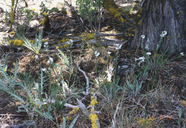
Hackelia cusickii, commonly known as Cusick's stickseed, is a perennial herb in the Boraginaceae that is found in California and elsewhere. It occurs within Alpine boulder and rock field, Pinyon and juniper woodland (rocky loam), and Subalpine coniferous forest, growing at elevations from 1200 to 2000 meters. Hackelia cusickii is ranked 4.3, Plants of Limited Distribution, A Watch List; Not very threatened in California.|
Scientific Name: Hackelia cusickii (Piper) Brand |
||
|
Common Name: Cusick's stickseed |
||
| Family: | Boraginaceae | |
| Element Code: | PDBOR0G090 | |
| USDA Plants Symbol: | HACU | |
|
Synonyms/Other Names: |
||
| Name Status: |
JEF, FNA, POWO, IPNI, Tropicos |
|
| CA Rare Plant Rank: | 4.3 |
| Fed List: | None |
| State List: | None |
| Global Rank: | G4 |
|
State Rank: |
S3S4 |
| Other Status: | |
|
CRPR Changes: |
|
| Add Date: | 1974-01-01 |
| Date Edited: | 2025-07-01 |
| Lifeform: perennial herb | ||||||||||||||
Blooming Period: Apr-Jul
|
||||||||||||||
|
Elevation:
1200 - 2000 meters 3935 - 6560 feet |
||||||||||||||
General Habitats:
|
||||||||||||||
| Microhabitat Details: | ||||||||||||||
|
Microhabitat:
|
||||||||||||||
| Threat List Total: | 0 | |
| Total EOs | % of EOs | |
| EOs with Threat Listed: | 0 | 0 % |
| THREAT LIST: | ||
|---|---|---|
| Total Occurrences: | 0 | ||||
| Element Occurrence Ranks: | |||||
|---|---|---|---|---|---|
| A | B | C | D | X | U |
| 0 | 0 | 0 | 0 | 0 | 0 |
| Occurrence Status: | |||||
|---|---|---|---|---|---|
| Historical >20 Years | 0 | ||||
| Recent <=20 Years | 0 | ||||
| Presence: | |||||
|---|---|---|---|---|---|
| Presumed Extant | 0 | ||||
| Possibly Extirpated | 0 | ||||
| Presumed Extirpated | 0 | ||||
| California Endemic: | |||||||||||||
| California Island: | |||||||||||||
|
States: Name (Code) California (CA), Nevada (NV), Oregon (OR) |
|||||||||||||
|
California Counties and Islands: Name (Code) Lassen (LAS), Modoc (MOD), Shasta (SHA), Siskiyou (SIS) |
|||||||||||||
|
Quads: Name (Quad Code) Ambrose (4112058), Ash Valley (4112016), Big Sage Reservoir (4112056), Boot Lake (4112012), Buckhorn Lake (4012081), Bullard Lake (4012078), Caldwell Butte (4112164), Captain Jacks Stronghold (4112175), Cedarville (4112052), Cold Spring Mtn. (4112013), Corders Reservoir (4012172), Davis Creek (4112063), Dixie Peak (4012181), Dodge Reservoir (4012082), Donica Mtn. (4112132), Dorris (4112188), Eagle Peak (4112032), Emerson Peak (4112022), Fort Bidwell (4112072), Fredonyer Peak (4012065), Grasshopper Valley (4012076), Graven Ridge (4112036), Hermit Butte (4112037), Jellico (4012173), Jess Valley (4112023), Juniper Ridge (4012083), Knobcone Butte (4112151), Lake Annie (4112081), Likely (4112025), Madeline (4112014), Mahogany Ridge (4112055), McGinty Reservoir (4112075), Mount Dome (4112176), Murken Bench (4012174), Observation Peak (4012072), Payne Peak (4112053), Perez (4112163), Poison Lake (4012162), Red Rock Lakes (4112177), Rimrock Lake (4112162), Sheep Mountain (4112178), Sheepshead (4012077), Sheepy Lake (4112187), Shields Creek (4112043), Shinn Mtn. (4012062), Silva Flat Reservoir (4012088), Snowstorm Mtn. (4012063), Soup Creek (4112033), Spalding Tract (4012067), Straylor Lake (4012171), Swains Hole (4012163), The Panhandle (4112174), Troxel Point (4012066), Tule Mountain (4112024), Warren Peak (4112042), Washington Mtn. (4112048), Whittemore Ridge (4112066) |
|||||||||||||
Notes:
|
|||||||||||||
 Presumed Extant
Click on quad for name. Hold Shift Key to use mouse scroll wheel


