Taxon Details
Brasenia schreberi
watershield
View Report Copy Link Calflora eFlora CCH CalPhotos iNaturalist
Taxon Summary:
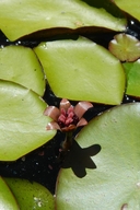
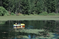
Brasenia schreberi, commonly known as watershield, is a perennial rhizomatous herb (aquatic) in the Cabombaceae that is found in California and elsewhere. It occurs within Marshes and swamps, growing at elevations from 0 to 2200 meters. Brasenia schreberi is ranked 2B.3, Plants Rare, Threatened, or Endangered in California, But More Common Elsewhere; Not very threatened in California.|
Scientific Name: Brasenia schreberi J.F. Gmel. |
||
|
Common Name: watershield |
||
| Family: | Cabombaceae | |
| Element Code: | PDCAB01010 | |
| USDA Plants Symbol: | BRSC | |
|
Synonyms/Other Names: |
||
| Name Status: |
JEF, FNA, POWO, IPNI, Tropicos |
|
| CA Rare Plant Rank: | 2B.3 |
| Fed List: | None |
| State List: | None |
| Global Rank: | G5 |
|
State Rank: |
S3 |
| Other Status: | IUCN_LC |
|
CRPR Changes: added to 2.3 on 2010-10-27 |
|
| Add Date: | 2010-10-27 |
| Date Edited: | 2025-10-29 |
| Lifeform: perennial rhizomatous herb (aquatic) | ||||||||||||||
Blooming Period: Jun-Sep
|
||||||||||||||
|
Elevation:
0 - 2200 meters 0 - 7220 feet |
||||||||||||||
General Habitats:
|
||||||||||||||
| Microhabitat Details: | ||||||||||||||
|
Microhabitat:
|
||||||||||||||
| Threat List Total: | 4 | |
| Total EOs | % of EOs | |
| EOs with Threat Listed: | 3 | 7 % |
| THREAT LIST: | ||
|---|---|---|
| Altered flood/tidal/hydrologic regime | 1 | 2% |
| Development | 1 | 2% |
| Non-native plant impacts | 1 | 2% |
| Road/trail construction/maint. | 1 | 2% |
| Total Occurrences: | 43 | ||||
| Element Occurrence Ranks: | |||||
|---|---|---|---|---|---|
| A | B | C | D | X | U |
| 6 | 1 | 0 | 0 | 4 | 32 |
| Occurrence Status: | |||||
|---|---|---|---|---|---|
| Historical >20 Years | 28 | ||||
| Recent <=20 Years | 15 | ||||
| Presence: | |||||
|---|---|---|---|---|---|
| Presumed Extant | 39 | ||||
| Possibly Extirpated | 2 | ||||
| Presumed Extirpated | 2 | ||||
| California Endemic: | |||||||||||||
| California Island: | |||||||||||||
|
States: Name (Code) Alabama (AL), Alaska (AK), Arkansas (AR), California (CA), Connecticut (CT), Delaware (DE), Florida (FL), Georgia (GA), Idaho (ID), Illinois (IL), Indiana (IN), Iowa (IA), Kansas (KS), Kentucky (KY), Louisiana (LA), Maine (ME), Maryland (MD), Massachusetts (MA), Michigan (MI), Minnesota (MN), Mississippi (MS), Missouri (MO), Montana (MT), Nebraska (NE), New Hampshire (NH), New Jersey (NJ), New York (NY), North Carolina (NC), Ohio (OH), Oklahoma (OK), Oregon (OR), Pennsylvania (PA), Rhode Island (RI), South Carolina (SC), South Dakota (SD), Tennessee (TN), Texas (TX), Vermont (VT), Virginia (VA), Washington (WA), West Virginia (WV), Wisconsin (WI) |
|||||||||||||
|
California Counties and Islands: Name (Code) Butte (BUT), Calaveras (CAL), El Dorado (ELD), Fresno (FRE), Glenn (GLE), Lake (LAK), Lassen (LAS), Mendocino (MEN), Merced (MER), Nevada (NEV), Plumas (PLU), Sacramento (SAC), San Joaquin (SJQ), Shasta (SHA), Sierra (SIE), Siskiyou (SIS), Sonoma (SON), Sutter (SUT), Tehama (TEH), Trinity (TRI), Tulare (TUL), Tuolumne (TUO) |
|||||||||||||
|
Quads: Name (Quad Code) Annapolis (3812363), Balls Ferry (4012242), Bouldin Island (3812115)*, Bray (4112168), Bruceville (3812134), Buck Rock (3912288), Burbeck (3912344), Cahto Peak (3912365), Calaveritas (3812025), Canyondam (4012121), Chalk Mtn. (4012187), Chester (4012132), Childs Meadows (4012134), Cisco Grove (3912035), Clearlake Highlands (3812286), Clearlake Oaks (3912216), Courtland (3812135), Crescent Mills (4012018), Echo Lake (3812071), Emerald Bay (3812081), Fall River Mills (4112114), Finley Butte (4012137), Florence Lake (3711838), Fort Mountain (3812034), Fredonyer Pass (4012037), Greenville (4012028), Hogback Ridge (4012184), Jamison Ridge (3912362), Kelseyville (3812287), Kern Lake (3611834), Lake Eleanor (3711987), Lakeport (3912218), Laughlin Range (3912333), Laytonville (3912364), Llano Seco (3912158), Longvale (3912354), Meadow Valley (3912181), Merced (3712034), Moonlight Peak (4012027), Mt. Givens (3711931), Mt. Harkness (4012143), Murphys (3812024), Oak Run (4012261), Quincy (3912088), Rail Road Flat (3812035), Red Cinder (4012142), Sanborn Slough (3912138), Sattley (3912054), Stockton West (3712183), Upper Lake (3912228), Westwood East (4012038), Westwood West (4012131), Zenia (4012324) |
|||||||||||||
Notes:
|
|||||||||||||
 Presumed Extant
Click on quad for name. Hold Shift Key to use mouse scroll wheel


