Taxon Details
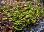
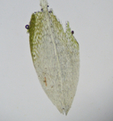
Anomobryum julaceum
slender silver moss
View Report Copy Link Calflora eFlora CCH CalPhotos iNaturalist
Taxon Summary:
Anomobryum julaceum, commonly known as slender silver moss, is a moss in the Bryaceae that is found in California and elsewhere. It occurs within Broadleafed upland forest, Lower montane coniferous forest, and North Coast coniferous forest, growing at elevations from 100 to 1000 meters. Anomobryum julaceum is ranked 4.2, Plants of Limited Distribution, A Watch List; Moderately threatened in California.|
Scientific Name: Anomobryum julaceum (Schrad. ex P. Gaertn., B. Mey. & Scherb) Schimp. |
||
|
Common Name: slender silver moss |
||
| Family: | Bryaceae | |
| Element Code: | NBMUS80010 | |
| USDA Plants Symbol: | ||
|
Synonyms/Other Names: |
||
| Name Status: |
JEF, FNA, POWO, IPNI, Tropicos |
|
| CA Rare Plant Rank: | 4.2 |
| Fed List: | None |
| State List: | None |
| Global Rank: | G5 |
|
State Rank: |
S2 |
| Other Status: | |
|
CRPR Changes: |
|
| Add Date: | 2001-01-01 |
| Date Edited: | 2024-08-06 |
| Lifeform: moss | ||||||||||||||
Blooming Period:
|
||||||||||||||
|
Elevation:
100 - 1000 meters 330 - 3280 feet |
||||||||||||||
General Habitats:
|
||||||||||||||
| Microhabitat Details: damp rock and soil on outcrops, usually on roadcuts | ||||||||||||||
Microhabitat:
|
||||||||||||||
| Threat List Total: | 2 | |
| Total EOs | % of EOs | |
| EOs with Threat Listed: | 2 | 15 % |
| THREAT LIST: | ||
|---|---|---|
| Road/trail construction/maint. | 2 | 15% |
| Erosion/runoff | 1 | 7% |
| Total Occurrences: | 13 | ||||
| Element Occurrence Ranks: | |||||
|---|---|---|---|---|---|
| A | B | C | D | X | U |
| 0 | 2 | 0 | 0 | 0 | 11 |
| Occurrence Status: | |||||
|---|---|---|---|---|---|
| Historical >20 Years | 11 | ||||
| Recent <=20 Years | 2 | ||||
| Presence: | |||||
|---|---|---|---|---|---|
| Presumed Extant | 13 | ||||
| Possibly Extirpated | 0 | ||||
| Presumed Extirpated | 0 | ||||
| California Endemic: | |||||||||||||
| California Island: | |||||||||||||
|
States: Name (Code) California (CA), Oregon (OR) |
|||||||||||||
|
California Counties and Islands: Name (Code) Butte (BUT), Contra Costa (CCA), Humboldt (HUM), Los Angeles (LAX), Mariposa (MPA), Monterey (MNT), San Mateo (SMT), Santa Barbara (SBA), Santa Cruz (SCR), Shasta (SHA), Sonoma (SON) |
|||||||||||||
|
Quads: Name (Quad Code) Antioch South (3712187), Big Basin (3712222), Clayton (3712188), Cone Peak (3612114), Diablo (3712178), El Portal (3711967), Felton (3712211), Ferndale (4012453), Igo (4012255), Las Trampas Ridge (3712271), Laurel (3712118), Mark West Springs (3812256), Pulga (3912174), San Marcos Pass (3411957), Tassajara (3712177), Walnut Creek (3712281), Waterman Mtn. (3411738), Weitchpec (4112326), Willow Creek (4012386), Yosemite Falls (3711975) |
|||||||||||||
Notes:
|
|||||||||||||
 Presumed Extant
Click on quad for name. Hold Shift Key to use mouse scroll wheel


