Taxon Details
Lepidium virginicum var. robinsonii
Robinson's pepper-grass
View Report Copy Link Calflora eFlora CCH CalPhotos iNaturalist
Taxon Summary:
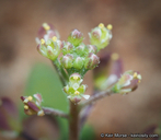
Lepidium virginicum var. robinsonii, commonly known as Robinson's pepper-grass, is a annual herb in the Brassicaceae that is found in California and elsewhere. It occurs within Chaparral, and Coastal scrub, growing at elevations from 1 to 885 meters. Lepidium virginicum var. robinsonii is ranked 4.3, Plants of Limited Distribution, A Watch List; Not very threatened in California.|
Scientific Name: Lepidium virginicum L. var. robinsonii (Thell.) Hitchc. |
||
|
Common Name: Robinson's pepper-grass |
||
| Family: | Brassicaceae | |
| Element Code: | PDBRA1M114 | |
| USDA Plants Symbol: | LEVIR | |
|
Synonyms/Other Names: |
||
| Name Status: |
JEF, FNA, POWO, IPNI, Tropicos |
|
| CA Rare Plant Rank: | 4.3 |
| Fed List: | None |
| State List: | None |
| Global Rank: | G5T3 |
|
State Rank: |
S3 |
| Other Status: | |
|
CRPR Changes: changed from 1B.2 to 4.3 on 2013-06-24 |
|
| Add Date: | 1994-01-01 |
| Date Edited: | 2025-10-29 |
| Lifeform: annual herb | ||||||||||||||
Blooming Period: Jan-Jul
|
||||||||||||||
|
Elevation:
1 - 885 meters 5 - 2905 feet |
||||||||||||||
General Habitats:
|
||||||||||||||
| Microhabitat Details: | ||||||||||||||
|
Microhabitat:
|
||||||||||||||
|
Notes: Previously CRPR 1B.2; more common than originally known. Threatened by development. Possibly threatened by non-native plants. A synonym of L. virginicum ssp. menziesii in TJM 2. See Mitteilungen aus dem Botanischen Museum der Universität Zürich 28:255-256 (1906) for original description and Madroño 3(7):265-320 (1936) for taxonomic treatment. |
|
|
Threats: |
|
|
Taxonomy: |
|
| Threat List Total: | 6 | |
| Total EOs | % of EOs | |
| EOs with Threat Listed: | 8 | 6 % |
| THREAT LIST: | ||
|---|---|---|
| Non-native plant impacts | 3 | 2% |
| Road/trail construction/maint. | 2 | 1% |
| Development | 2 | 1% |
| Foot traffic/trampling | 2 | 1% |
| Grazing | 1 | 0% |
| Wood cutting or brush clearing | 1 | 0% |
| Total Occurrences: | 142 | ||||
| Element Occurrence Ranks: | |||||
|---|---|---|---|---|---|
| A | B | C | D | X | U |
| 1 | 6 | 5 | 1 | 1 | 128 |
| Occurrence Status: | |||||
|---|---|---|---|---|---|
| Historical >20 Years | 108 | ||||
| Recent <=20 Years | 34 | ||||
| Presence: | |||||
|---|---|---|---|---|---|
| Presumed Extant | 141 | ||||
| Possibly Extirpated | 1 | ||||
| Presumed Extirpated | 0 | ||||
| California Endemic: | |||||||||||||
| California Island: | |||||||||||||
|
States: Name (Code) Baja California (BA), California (CA) |
|||||||||||||
|
California Counties and Islands: Name (Code) Los Angeles (LAX), Mono (MNO), Orange (ORA), Riverside (RIV), San Bernardino (SBD), San Diego (SDG), Santa Barbara (SBA), Ventura (VEN) |
|||||||||||||
|
Quads: Name (Quad Code) Aguanga (3311647), Alberhill (3311764), Alpine (3211677), Azusa (3411728), Bachelor Mtn. (3311751), Barrett Lake (3211666), Beauty Mountain (3311646), Black Star Canyon (3311776), Bucksnort Mtn. (3311645), Butterfly Peak (3311655), Campo (3211654), Corona North (3311785), Corona South (3311775), Del Mar (3211782), Dulzura (3211667), El Cajon (3211678), El Cajon Mtn. (3211687), El Casco (3311781), El Toro (3311766), Encinitas (3311713), Escondido (3311711), Fallbrook (3311743), Fontana (3411714), Glendora (3411727), Hemet (3311668), Imperial Beach (3211751), Jamul Mountains (3211668), La Jolla (3211772), La Mesa (3211771), Lake Elsinore (3311763), Lake Mathews (3311774), Las Pulgas Canyon (3311734), Lompoc (3412064), Los Angeles (3411812), Margarita Peak (3311744), Morena Reservoir (3211665), Morro Hill (3311733), Mount Dana (3711982), Mt. Baldy (3411726), Mt. Wilson (3411821), Murrieta (3311752), National City (3211761), Newbury Park (3411828), Ojai (3411942), Ontario (3411716), Otay Mesa (3211658), Otay Mountain (3211657), Pala (3311731), Pechanga (3311741), Point Loma (3211762), Poway (3211781), Prado Dam (3311786), Rancho Santa Fe (3311712), Redlands (3411712), Riverside East (3311783), Riverside West (3311784), Rodriquez Mtn. (3311628), Romoland (3311762), Sage (3311658), San Bernardino South (3411713), San Clemente (3311745), San Clemente Island North (3211885), San Clemente Island South (3211873), San Dimas (3411717), San Fernando (3411834), San Luis Rey (3311723), San Marcos (3311722), San Nicolas Island (3311924), San Onofre Bluff (3311735), San Pasqual (3311618), San Vicente Reservoir (3211688), Santa Cruz Island A (3311987), Santa Cruz Island B (3311986), Santa Cruz Island C (3311985), Santiago Peak (3311765), Sitton Peak (3311754), Steele Peak (3311773), Sunland (3411833), Sunnymead (3311782), Surf (3412065), Tecate (3211656), Temecula (3311742), Tustin (3311767), Vail Lake (3311648), Valley Center (3311721), Viejas Mountain (3211676), Winchester (3311761), Yorba Linda (3311787), Yucaipa (3411711) |
|||||||||||||
Notes:
|
|||||||||||||
 Presumed Extant
Click on quad for name. Hold Shift Key to use mouse scroll wheel


