Taxon Details
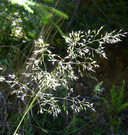
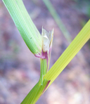
Calamagrostis bolanderi
Bolander's reed grass
View Report Copy Link Calflora eFlora CCH CalPhotos iNaturalist
Taxon Summary:
Calamagrostis bolanderi, commonly known as Bolander's reed grass, is a perennial rhizomatous herb in the Poaceae that is found only in California. It occurs within Bogs and fens, Broadleafed upland forest, Closed-cone coniferous forest, Coastal scrub, Marshes and swamps (freshwater), Meadows and seeps (mesic), and North Coast coniferous forest, growing at elevations from 0 to 455 meters. Calamagrostis bolanderi is ranked 4.2, Plants of Limited Distribution, A Watch List; Moderately threatened in California.|
Scientific Name: Calamagrostis bolanderi Thurb. |
||
|
Common Name: Bolander's reed grass |
||
| Family: | Poaceae | |
| Element Code: | PMPOA17010 | |
| USDA Plants Symbol: | CABO | |
|
Synonyms/Other Names: |
||
| Name Status: |
JEF, FNA, POWO, IPNI, Tropicos |
|
| CA Rare Plant Rank: | 4.2 |
| Fed List: | None |
| State List: | None |
| Global Rank: | G4 |
|
State Rank: |
S4 |
| Other Status: | |
|
CRPR Changes: changed from 1B to 4.2 on 2003-03-14 |
|
| Add Date: | 1974-01-01 |
| Date Edited: | 2025-10-29 |
| Lifeform: perennial rhizomatous herb | ||||||||||||||
Blooming Period: May-Aug
|
||||||||||||||
|
Elevation:
0 - 455 meters 0 - 1495 feet |
||||||||||||||
General Habitats:
|
||||||||||||||
| Microhabitat Details: | ||||||||||||||
Microhabitat:
|
||||||||||||||
| Threat List Total: | 0 | |
| Total EOs | % of EOs | |
| EOs with Threat Listed: | 0 | 0 % |
| THREAT LIST: | ||
|---|---|---|
| Total Occurrences: | 0 | ||||
| Element Occurrence Ranks: | |||||
|---|---|---|---|---|---|
| A | B | C | D | X | U |
| 0 | 0 | 0 | 0 | 0 | 0 |
| Occurrence Status: | |||||
|---|---|---|---|---|---|
| Historical >20 Years | 0 | ||||
| Recent <=20 Years | 0 | ||||
| Presence: | |||||
|---|---|---|---|---|---|
| Presumed Extant | 0 | ||||
| Possibly Extirpated | 0 | ||||
| Presumed Extirpated | 0 | ||||
| California Endemic: | |||||||||||||
| California Island: | |||||||||||||
|
States: Name (Code) California (CA) |
|||||||||||||
|
California Counties and Islands: Name (Code) Humboldt (HUM), Mendocino (MEN), Sonoma (SON) |
|||||||||||||
|
Quads: Name (Quad Code) Annapolis (3812363), Comptche (3912335), Crannell (4112411), Dutchmans Knoll (3912356), Elk (3912326), Eureka Hill (3812385), Fort Bragg (3912347), Gualala (3812375), Hales Grove (3912377), Inglenook (3912357), Mallo Pass Creek (3912316), Mathison Peak (3912336), Mendocino (3912337), Navarro (3912325), Northspur (3912345), Noyo Hill (3912346), Piercy (3912387), Plantation (3812353), Point Arena (3812386), Rodgers Peak (4112421), Saunders Reef (3812376), Sebastopol (3812247), Sherwood Peak (3912355), Stewarts Point (3812364), Trinidad (4112412), Two Rock (3812237) |
|||||||||||||
Notes:
|
|||||||||||||
 Presumed Extant
Click on quad for name. Hold Shift Key to use mouse scroll wheel


