Taxon Details
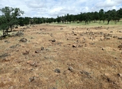
Polygonum bidwelliae
Bidwell's knotweed
View Report Copy Link Calflora eFlora CCH CalPhotos iNaturalist

©2020 Neal Kramer |
©2020 Neal Kramer |
Taxon Summary:
Polygonum bidwelliae, commonly known as Bidwell's knotweed, is a annual herb in the Polygonaceae that is found only in California. It occurs within Chaparral, Cismontane woodland, and Valley and foothill grassland, growing at elevations from 60 to 1200 meters. Polygonum bidwelliae is ranked 4.3, Plants of Limited Distribution, A Watch List; Not very threatened in California.|
Scientific Name: Polygonum bidwelliae Wats. |
||
|
Common Name: Bidwell's knotweed |
||
| Family: | Polygonaceae | |
| Element Code: | PDPGN0L0C0 | |
| USDA Plants Symbol: | POBI4 | |
|
Synonyms/Other Names: |
||
| Name Status: |
JEF, FNA, POWO, IPNI, Tropicos |
|
| CA Rare Plant Rank: | 4.3 |
| Fed List: | None |
| State List: | None |
| Global Rank: | G4 |
|
State Rank: |
S4 |
| Other Status: | |
|
CRPR Changes: |
|
| Add Date: | 1974-01-01 |
| Date Edited: | 2025-10-29 |
| Lifeform: annual herb | ||||||||||||||
Blooming Period: Apr-Jul
|
||||||||||||||
|
Elevation:
60 - 1200 meters 195 - 3935 feet |
||||||||||||||
General Habitats:
|
||||||||||||||
| Microhabitat Details: | ||||||||||||||
Microhabitat:
|
||||||||||||||
| Threat List Total: | 0 | |
| Total EOs | % of EOs | |
| EOs with Threat Listed: | 0 | 0 % |
| THREAT LIST: | ||
|---|---|---|
| Total Occurrences: | 0 | ||||
| Element Occurrence Ranks: | |||||
|---|---|---|---|---|---|
| A | B | C | D | X | U |
| 0 | 0 | 0 | 0 | 0 | 0 |
| Occurrence Status: | |||||
|---|---|---|---|---|---|
| Historical >20 Years | 0 | ||||
| Recent <=20 Years | 0 | ||||
| Presence: | |||||
|---|---|---|---|---|---|
| Presumed Extant | 0 | ||||
| Possibly Extirpated | 0 | ||||
| Presumed Extirpated | 0 | ||||
| California Endemic: | |||||||||||||
| California Island: | |||||||||||||
|
States: Name (Code) California (CA) |
|||||||||||||
|
California Counties and Islands: Name (Code) Butte (BUT), Shasta (SHA), Tehama (TEH) |
|||||||||||||
|
Quads: Name (Quad Code) Acorn Hollow (4012118), Barkley Mtn. (4012126), Bend (4012232), Burney (4012186), Burney Falls (4112116), Campbell Mound (3912187), Cherokee (3912165), Cohasset (3912186), Dales (4012231), Devils Parade Ground (4012116), Dewitt Peak (4012128), Finley Butte (4012137), Hagaman Gulch (4012157), Hamlin Canyon (3912166), Inwood (4012158), Los Molinos (4012211), Manton (4012147), Panther Spring (4012127), Paradise East (3912175), Paradise West (3912176), Richardson Springs (3912177), Shippee (3912156), Tuscan Buttes Ne (4012241), Tuscan Springs (4012221) |
|||||||||||||
Notes:
|
|||||||||||||
 Presumed Extant
Click on quad for name. Hold Shift Key to use mouse scroll wheel