Taxon Details
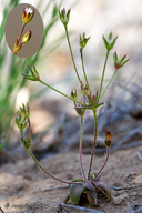
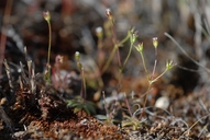
Androsace elongata ssp. acuta
California androsace
View Report Copy Link Calflora eFlora CCH CalPhotos iNaturalist
Taxon Summary:
Androsace elongata ssp. acuta, commonly known as California androsace, is a annual herb in the Primulaceae that is found in California and elsewhere. It occurs within Chaparral, Cismontane woodland, Coastal scrub, Meadows and seeps, Pinyon and juniper woodland, and Valley and foothill grassland, growing at elevations from 150 to 1305 meters. Androsace elongata ssp. acuta is ranked 4.2, Plants of Limited Distribution, A Watch List; Moderately threatened in California.|
Scientific Name: Androsace elongata L. ssp. acuta (Greene) Robbins |
||
|
Common Name: California androsace |
||
| Family: | Primulaceae | |
| Element Code: | PDPRI02031 | |
| USDA Plants Symbol: | ANELA | |
|
Synonyms/Other Names: |
||
| Name Status: |
JEF, FNA, POWO, IPNI, Tropicos |
|
| CA Rare Plant Rank: | 4.2 |
| Fed List: | None |
| State List: | None |
| Global Rank: | G5?T3T4 |
|
State Rank: |
S3S4 |
| Other Status: | SB_CalBG/RSABG; SB_USDA |
|
CRPR Changes: |
|
| Add Date: | 1994-01-01 |
| Date Edited: | 2025-10-29 |
| Lifeform: annual herb | ||||||||||||||
Blooming Period: Mar-Jun
|
||||||||||||||
|
Elevation:
150 - 1305 meters 490 - 4280 feet |
||||||||||||||
General Habitats:
|
||||||||||||||
| Microhabitat Details: | ||||||||||||||
|
Microhabitat:
|
||||||||||||||
|
Notes: Highly localized and often overlooked; many occurrences extirpated. Very rare in Southern CA. Endangered in OR. See American Midland Naturalist 32:132-163 (1944) for taxonomic treatment. |
|
|
Threats: Possibly threatened by grazing, trampling, non-native plants, alteration of fire regimes, and recreational activities. Potentially threatened by wind energy development. |
|
|
Taxonomy: |
|
| Threat List Total: | 0 | |
| Total EOs | % of EOs | |
| EOs with Threat Listed: | 0 | 0 % |
| THREAT LIST: | ||
|---|---|---|
| Total Occurrences: | 0 | ||||
| Element Occurrence Ranks: | |||||
|---|---|---|---|---|---|
| A | B | C | D | X | U |
| 0 | 0 | 0 | 0 | 0 | 0 |
| Occurrence Status: | |||||
|---|---|---|---|---|---|
| Historical >20 Years | 0 | ||||
| Recent <=20 Years | 0 | ||||
| Presence: | |||||
|---|---|---|---|---|---|
| Presumed Extant | 0 | ||||
| Possibly Extirpated | 0 | ||||
| Presumed Extirpated | 0 | ||||
| California Endemic: | |||||||||||||
| California Island: | |||||||||||||
|
States: Name (Code) Baja California (BA), California (CA), Oregon (OR)* |
|||||||||||||
|
California Counties and Islands: Name (Code) Alameda (ALA), Colusa (COL), Contra Costa (CCA), Fresno (FRE), Glenn (GLE), Kern (KRN), Los Angeles (LAX), Merced (MER), Monterey (MNT), Riverside (RIV), San Benito (SBT), San Bernardino (SBD), San Diego (SDG), San Joaquin (SJQ), San Luis Obispo (SLO), San Mateo (SMT), Santa Clara (SCL), Siskiyou (SIS), Stanislaus (STA), Tehama (TEH) |
|||||||||||||
|
Quads: Name (Quad Code) Altamont (3712166), Anza (3311656), Ballinger Canyon (3411984), Bena (3511836), Big Bear City (3411637), Breckenridge Mtn. (3511845), Briones Valley (3712282), Burnt Peak (3411865), Byron Hot Springs (3712176), Caliente Mtn. (3511917), Cedar Mtn. (3712155), Cerro Colorado (3612068), Chimineas Ranch (3511928), Cholame Valley (3512073), Chrome (3912265), Clayton (3712188), Cummings Mtn. (3511815), Cuyamaca Peak (3211685), Descanso (3211675), Diablo (3712178), Elkhorn Hills (3511915), Etna (4112248), Eylar Mtn. (3712145), Fairview Valley (3411751), Fifteenmile Valley (3411741), Gilmore Peak (3912235), Glennville (3511866), Greenview (4112258), Hernandez Reservoir (3612047), Hot Springs Mtn. (3311635), Idyllwild (3311666), Isabel Valley (3712135), Julian (3311615), Keller Peak (3411721), La Costa Valley (3712157), La Liebre Ranch (3411876), Lake Arrowhead (3411732), Lake Isabella South (3511854), Las Yeguas Ranch (3511948), Lebec (3411877), Lick Observatory (3712136), Liebre Mtn. (3411866), Lillis Ranch (3612044), Llanada (3612058), Logan Ridge (3912243), Lowrey (4012215), Midway (3712165), Miracle Hot Springs (3511855), Morgan Hill (3712126), Mountain View (3712241), Mt. Boardman (3712144), Newville (3912275), Ortigalita Peak (3612078), Ortigalita Peak NW (3612088), Pacifico Mountain (3411841), Palm View Peak (3311665), Palo Alto (3712242), Panoche Pass (3612161), Panorama Hills (3511926), Pastoria Creek (3411887), Rail Canyon (3912244), Ranchita (3311625), Ritter Ridge (3411852), San Dimas (3411717), San Jose East (3712137), Santa Teresa Hills (3712127), Santiago Creek (3411983), Silverwood Lake (3411733), Smith Mountain (3612015), Tehachapi North (3511824), Tehachapi South (3511814), Tejon Ranch (3511816), Tent Hills (3512072), Tubb Canyon (3311624), Warner Springs (3311636), White Horse Mtn. (3411658), Woolstalf Creek (3511853), Yreka (4112266) |
|||||||||||||
Notes:
|
|||||||||||||
 Presumed Extant
Click on quad for name. Hold Shift Key to use mouse scroll wheel


